
















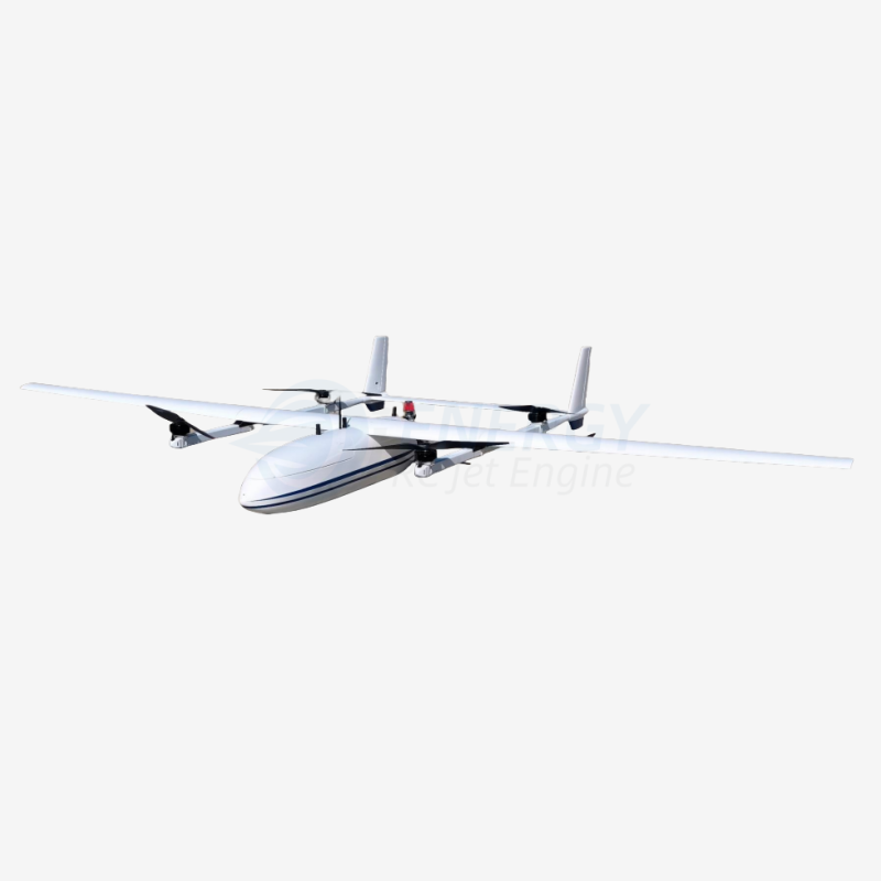
VTOL Fixed-Wing Hybrid UAV – 5.45 m Professional Vertical Takeoff & Long-Range Drone for Mapping, Survey, Inspection & Delivery Missions
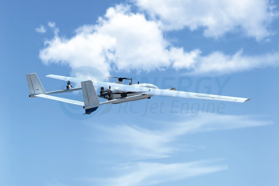
The VTOL Fixed-Wing Hybrid UAV is a next-generation industrial drone designed for companies, government agencies, engineering teams, and global operators who require long-range flights, heavy payload capacity, vertical takeoff flexibility, and precise aerial data acquisition.
Integrating helicopter-style vertical lift with high-efficiency fixed-wing cruise, this aircraft delivers superior endurance, flight stability, and mission capability across surveying, mapping, industrial inspection, logistics delivery, emergency response, and environmental monitoring.
Built for international deployment across mountains, deserts, rainforests, coastal regions, plateaus and high-wind areas, the platform solves the traditional limitations of multi-rotor drones while offering runway-free operations compared to typical fixed-wing UAVs.
It is an advanced, professional-grade VTOL aircraft engineered for global commercial UAV operations.
Technical Specifications — VTOL Fixed-Wing Hybrid Drone
| المعلمة | Value |
|---|---|
| Wingspan | 5.45 m |
| Length | 3.05 m |
| Height | 0.92 m |
| Maximum Takeoff Weight | 100 kg |
| سرعة الرحلة البحرية | 100–120 km/h |
| Maximum Flight Speed | 140 km/h |
| Climb Rate | 5 m/s (Sea Level) |
| Service Ceiling | 6000 m (at 75 kg MTOW) |
| Maximum Takeoff Altitude | 4200 m |
| Endurance | 5 hours (with 25 kg payload) |
| Maximum Payload | ≥ 25 kg |
| مقاومة الرياح | Level 5 (takeoff & landing) |
| Positioning & Navigation | RTK High-Precision GNSS (GPS + BeiDou + Multi-Constellation) |
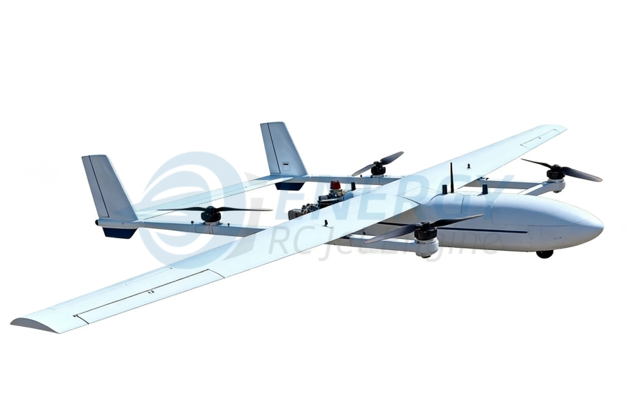
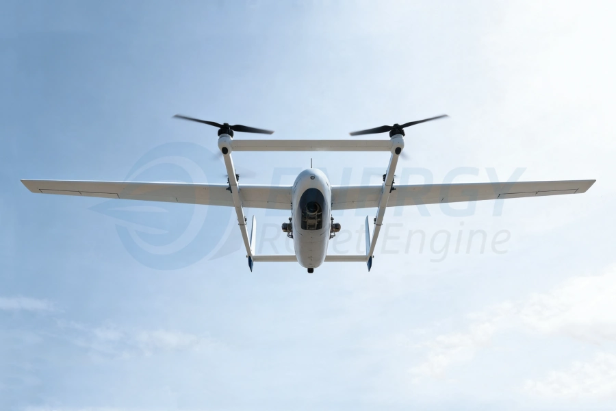
1. Advanced VTOL Hybrid Architecture
This long-range VTOL aircraft uses a multi-rotor lifting system for vertical ascent and a fixed-wing cruise system for forward flight.
Key advantages:
True vertical takeoff & landing (VTOL)
No runway / launch catapult required
Lower power consumption than multi-rotors
Higher endurance and long-range capability
Strong wind resistance due to fixed-wing stability
Safe, reliable autonomous transition system
This hybrid format is ideal for mapping drones, survey UAVs, logistics drones, inspection aircraft, and long-distance industrial missions.
2. Industrial-Grade Airframe & Aerodynamic Efficiency
The 5.45 m wingspan ensures high lift efficiency, reduced drag, and stable long-duration cruise flight.
Its composite airframe combines:
High-strength aviation materials
Lightweight carbon-fiber structure
Dust-resistant and rain-tolerant surfaces
Anti-interference shielding for industrial zones
Reinforced landing legs for uneven terrain
Designed for demanding environments, the aircraft can operate in mountain plateaus up to 4200 m and perform 6000 m flight ceilings, making it suitable for high-altitude mapping missions.
3. Professional Payload Compatibility
This VTOL mapping and industrial UAV supports a wide range of payloads:
Aerial Mapping & Photogrammetry Payloads
Full-frame 42MP / 61MP cameras
Oblique photogrammetry systems
High-resolution RGB imaging
Large-area mapping modules
Surveying & LiDAR Payloads
LiDAR scanners (Topo, Bathy, Corridor)
3D terrain & forest canopy scanning
Engineering-grade geospatial data collection
Industrial Inspection Payloads
Powerline, pipeline, railway inspection
Oil & gas monitoring
Solar farm and wind turbine inspection
Bridge & structural inspection
Delivery & Logistic Payloads
25 kg cargo pods
Medical supplies transport
Remote area delivery missions
This makes it one of the most versatile long-range VTOL fixed-wing drones available on the international market.
4. Long-Endurance Power System
The aircraft achieves:
5 hours endurance with 25 kg payload
Low power consumption in cruise mode
Optimized hybrid propulsion architecture
Intelligent energy distribution & monitoring
Operators can conduct large-area mapping missions, cross-terrain reconnaissanceأو multi-hour industrial inspections without interruption.
5. High-Accuracy RTK GNSS Navigation
Integrated GNSS system includes:
RTK high-precision positioning
GPS + BeiDou + GLONASS + Galileo
Anti-jamming navigation algorithms
Centimeter-level accuracy for mapping
This makes the UAV ideal for survey-grade photogrammetry where accuracy is critical.
6. Autopilot, Mission Software & Flight Control
The intelligent UAV flight control system supports:
Automatic VTOL takeoff
Autonomous cruise & return
Terrain-following mode
Smart emergency landing
Real-time health monitoring
Transition automation (VTOL → fixed-wing → VTOL)
Geofencing + no-fly zone protection
Operators can plan missions via PC/GCS with global map integration.
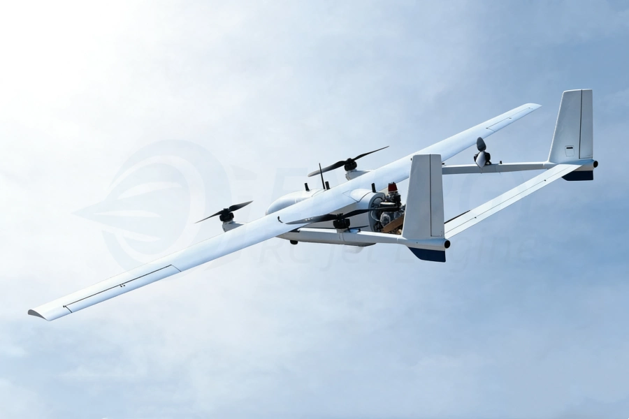
7. Global Applications & Industry Sectors
Geospatial Mapping & Surveying
Topographic mapping
رسم خرائط الممرات (الطرق والسكك الحديدية وخطوط الأنابيب)
Cadastral surveying
Mining & quarry mapping
Industrial Inspection & Monitoring
Powerline inspection
Substation monitoring
Oil & gas pipeline corridor surveillance
Wind & solar farm inspection
Agriculture & Environmental Applications
Crop analysis & vegetation mapping
Forest management
Wildlife monitoring
Environmental change detection
Public Safety & Security
دوريات الحدود
Anti-smuggling & anti-poaching
Disaster assessment
Emergency search & rescue
Transport & Delivery UAV Missions
Medical supply transport
Remote logistics
On-demand parcel delivery
This VTOL fixed-wing drone is engineered for global enterprise-level UAV operations.
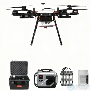
8. System Components (Full Set)
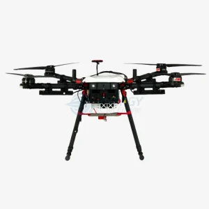
VTOL Fixed-Wing Aircraft Body
Multi-Rotor Lift Motors & ESCs
Fixed-Wing Cruise Propulsion System
Flight Control Computer & Navigation Module
RTK GNSS Base Station
Ground Control Station (GCS)
Long-Range Data Link System
Payload Mounting Rack
Battery Packs & Power Management System
Transport Case / Field Deployment Kit
9. Safety, Redundancy & Reliability
The aircraft includes professional-grade safety systems:
Redundant power supply
Multiple IMU sensors
Automatic return-to-home (RTH)
Loss-of-signal safety protocols
Wind-resistant design
Smart diagnostics before takeoff
Motor/ESC overheating protection
Built for international commercial UAV regulations.
10. Why Choose This VTOL Mapping & Industrial UAV?
✔ True Vertical Takeoff, No Runway Needed
✔ 5-Hour Long-Endurance Flight
✔ 25 kg Heavy Payload Capacity
✔ High Precision RTK Survey-Grade Accuracy
✔ Suitable for High Altitude and Harsh Environments
✔ Multipurpose: Mapping, Survey, Delivery, Inspection
✔ Global Operation Ready for Any Industry
11. FAQ – Frequently Asked Questions
Q1. What is the maximum flight endurance?
Up to 5 hours with a 25 kg payload, depending on environmental conditions.
Q2. Can the UAV operate in high-altitude regions?
Yes.
Max takeoff altitude: 4200 m
Flight ceiling: 6000 m
Ideal for mountain, plateau, and desert missions.
Q3. What payloads are supported?
LiDAR, full-frame cameras, oblique cameras, multispectral sensors, EO/IR gimbals, cargo pods, and custom payloads up to ≥25 kg.
Q4. Does it require a runway?
No runway is needed. It uses helicopter-style vertical lift for takeoff and landing.
Q5. What industries use this drone?
Surveying, mapping, oil & gas, utilities, logistics, agriculture, security, emergency response, mining, environment, and more.
Q6. Can this UAV be shipped internationally?
Yes. The aircraft is designed for global export, with customers across North America, South America, Europe, the Middle East, Australia, and Asia.
Q7. Do you offer OEM / ODM custom
Yes —Energy-RCJetEngine provides full OEM and ODM services for our VTOL Fixed-Wing Hybrid UAV.
محرك نفاث توربيني بقوة 85 كيلوغرامًا من القوة: نظام دفع مدمج عالي الدفع للطائرات بدون طيار والطائرات النفاثة التي يتم التحكم فيها عن بُعد
مع استمرار تطور الطائرات بدون طيار والطائرات التجريبية والطائرات النفاثة ذات التحكم عن بُعد عالية الأداء، فإن أنظمة الدفع تحتاج إلى [...]
سبتمبر

دليل مصنعي محركات النفاثة الصغيرة لعام 2026: كيفية اختيار المورد المناسب لمحركات الطائرات بدون طيار
دليل مصنعي محركات التوربوجيت الصغيرة لعام 2026: اختيار الشريك المناسب في مجال الدفع للطائرات بدون طيار والفضاء [...]
يوليو
محركات نفاثة صغيرة بقوة 6–10 كيلوغرام-قوة مخصصة للطائرات بدون طيار والطائرات النفاثة التي يتم التحكم فيها عن بُعد: الأداء والتطبيقات ودليل الاختيار
مقدمة: مع استمرار تطور منصات الطائرات بدون طيار خفيفة الوزن، والطائرات النفاثة التي يتم التحكم فيها عن بُعد، ومشاريع الطيران التجريبية، [...]
يوليو
دليل أسعار محركات التوربوجيت الصغيرة (2026): التكاليف والمواصفات ونظرة عامة على الموردين
دليل أسعار المحركات النفاثة الصغيرة (2026) إذا كنت تبحث عن محرك نفاث صغير من أجل [...]
مايو
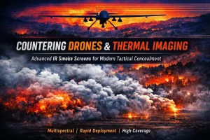
كيف تُستخدم ستائر الدخان لمواجهة الطائرات بدون طيار والتصوير الحراري في العمليات التكتيكية الحديثة
مقدمة: نهاية مفهوم الإخفاء التقليدي في البيئات التكتيكية الحديثة، فإن مفهوم الإخفاء [...]
مارس
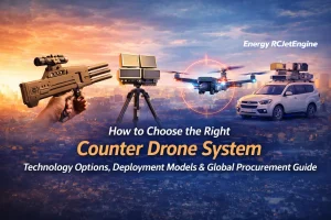
كيفية اختيار نظام مكافحة الطائرات المسيرة المناسب: الخيارات التكنولوجية، ونماذج النشر، ودليل الشراء العالمي
مع تزايد توفر المركبات الجوية غير المأهولة (UAVs) في جميع أنحاء العالم، تواجه المؤسسات في مختلف القطاعات [...]
جان
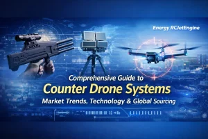
دليل شامل لأنظمة التصدي للطائرات بدون طيار: اتجاهات السوق والتكنولوجيا والتوريد العالمي
في السنوات الأخيرة، أصبحت أنظمة التصدي للطائرات بدون طيار — والمعروفة أيضًا باسم أنظمة التصدي للطائرات غير المأهولة (C-UAS) — عنصرًا أساسيًّا [...]
جان
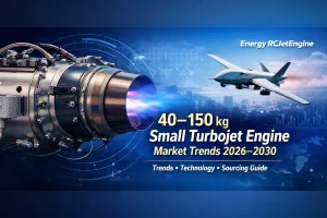
سوق محركات التوربوجيت الصغيرة العالمية (40–150 كجم) (2026–2030): الاتجاهات والتكنولوجيا ودليل التوريد
مقدمة: يشهد الطلب العالمي على المحركات النفاثة الصغيرة ذات قوة الدفع التي تتراوح بين 40 و150 كيلوغرامًا نموًا سريعًا، مدفوعًا بـ [...]
جان
المراجعات
لا توجد مراجعات بعد.